|
|
|
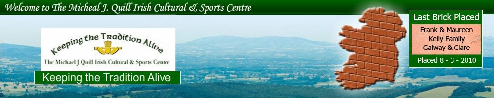
The Irish Park, this is a real 1-acre life size map of Ireland made out of red bricks and the main fundraiser for the Irish village. It is the largest map of Ireland in the world with all the counties accurately marked out. Each county has it’s own county flag placed on it to mark exactly which one you are in. Apart from being an amazing map to walk around it is also very educational and a great way to brush up on your geography of Ireland.
The park was built in 2001 at a cost of 500,000. It was funded in part by New York State, Greene County and the rest was fundraised by the MJQICSC. The park was a significant step in developing a unique Irish Sports and Cultural Centre.
To raise money for other projects on the grounds the MJQICSC use this park as a fundraising method. For $100 you can get a brick engraved with whatever you would like on it. Most bricks are engraved with messages from people who visited the grounds and were amazed with its beauty and had a feeling that their feet really were in Ireland. The other main messages on the bricks are memorials for passed loved ones. These bricks are generally placed in the counties where the people come from.
It is also very interesting to read all the messages people have had engraved on the bricks.
We will soon have every one of the engraved bricks listed on our website, please join the website newsletter to be informed of when we launch the application.
|
|
|
|


 Copyright © 2011 Irish Village USA. All Rights Reserved. Web Development & SEO by: SEO Professionals |